A 100% owned oxide gold silver exploration property in Northern Peru, hosted in brecciated Chimu Formation quartzites with historical underground workings.
100%Owned by Peruvian Metals
~500 haAncash Department, Northern Peru
0.73 g/t AuAverage gold grade across 36 random underground samples
66.9 g/t AgAverage silver grade across 36 random underground samples
292 kmFrom Aguila Norte by mostly asphalt roads
Oxide Au-AgHosted in brecciated Chimu Formation quartzites
Location
Ancash Department, Northern Peru
Minas Yanayco
Ancash Department, Northern Peru, near Pueblo Libre, 100% owned by Peruvian Metals
Distance to plant
Approximately 292 km from Aguila Norte by mostly asphalt roads
Property size
Approximately 500 hectares
Host rocks
Fractured, brecciated and faulted Chimu Formation quartzites
Stage
Early stage exploration, held as exploration optionality
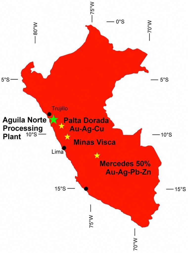
Minas Yanayco is not shown on this map. The map shows the Aguila Norte plant and the Company’s Palta Dorada, Mercedes and Minas Visca projects. An updated map is in preparation. Property area is subject to confirmation against the Company’s continuous disclosure.
Project overview and snapshot
An oxide gold silver exploration property in Northern Peru
Minas Yanayco is a 100% owned gold silver property in the Ancash Department of Northern Peru, near the town of Pueblo Libre. The property covers approximately 500 hectares and is reached from the Aguila Norte processing plant by roughly 292 kilometres of mostly asphalt roads.
The property hosts epithermal oxide gold silver mineralization within fractured, brecciated and faulted quartzites of the Chimu Formation. Historical mining took place at the Yanayco Mine during the late 1970s and early 1980s, when oxide gold material was treated on site. Minas Yanayco is at an earlier stage than Palta Dorada and Mercedes and is held as exploration optionality rather than as a near term development asset.
Minas Yanayco at a glance
Ownership
100% Peruvian Metals
Commodity focus
Gold and silver
Mineralization style
Epithermal oxide gold silver
Location
Ancash Department, Northern Peru, near Pueblo Libre
Property size
Approximately 500 hectares
Distance to Aguila Norte
Approximately 292 km by mostly asphalt roads
Host rocks
Fractured, brecciated and faulted Chimu Formation quartzites
Historical workings
Narrow historical tunnels and a larger mechanically exploited stope
Historical production
Yanayco Mine, late 1970s and early 1980s
Stage
Early stage exploration. No mineral resource estimate.
Averages are shown rather than best individual results. Individual sample highs are reported in the sampling section below.
Geology
Mineralization hosted in brecciated Chimu quartzites
Minas Yanayco is hosted in quartzites of the Cretaceous age Chimu Formation, where oxide gold silver mineralization occurs within fractured, brecciated and faulted rock. Historical mine workings are localized in a highly brecciated fault zone running parallel to the hinge of an overturned, tightly folded syncline.
Gold mineralization in these quartzites is deposited along fracture surfaces by hydrothermal activity. Where the host rocks are oxidized, gold can become free and potentially more amenable to leaching with limited crushing. Company observations indicate that gold and silver grades increase with the intensity of brecciation, and that mineralization is associated with a large northeast trending reverse thrust fault. Structural analysis suggests the larger brecciated zones are associated with conjugate sets of shears and faults, giving the Company a structural target where those fault systems intersect.
Host rock Chimu Formation quartzites
Mineralization epithermal oxide gold silver
Structural setting brecciated fault zone near the hinge of an overturned syncline
Geological interpretations are the Company’s own and remain to be confirmed by systematic exploration.
Regional setting, Ancash Department, Northern Peru. Project specific photography for Minas Yanayco is not currently available.
Historical workings
Prior mining activity across two periods
The property contains significant historical mine workings reflecting multiple periods of prior exploitation, including small historical tunnels and a larger mechanically exploited stope. Some platforms from historical processing equipment remain on the property.
Historical mining period
Late 1970s and early 1980s
Mining style
Narrow historical tunnels and a mechanically exploited stope
Main stope area
Approximately 3,450 square metres
Stope length
Approximately 170 metres into the hill
Stope width
Up to 30 metres
Historical treatment
Oxide gold material treated on site
Sampling
Underground and mine dump sampling results
Sample set
Results
36 random underground samples
Average of 0.73 g/t Au and 66.9 g/t Ag
Highest individual underground samples
Up to 7.33 g/t Au over 0.6 metres, and up to 1,058 g/t Ag over 0.4 metres, in separate samples
14 grab samples, old mine dumps
Average of 0.81 g/t Au and 151 g/t Ag, with individual samples up to 4 g/t Au and 431 g/t Ag
Underground samples are random in nature and grab samples from mine dumps are selective by nature. Neither is necessarily representative of mineralization across the property, and the highest individual results are not representative of average grade. Further systematic mapping and sampling are required to define any mineralized zones.
Exploration plan
Mapping structural controls and defining targets
The next phase of work is expected to focus on understanding the structural controls on gold silver mineralization, and on defining the relationship between brecciation intensity, faulting, oxidation and precious metals values.
Mapping detailed geological mapping and structural interpretation of brecciated zones
Sampling follow up sampling of underground workings and historical mine dumps
Evaluation assessment of oxide gold silver zones
Targets identification of priority targets for further work
Gallery
Project images
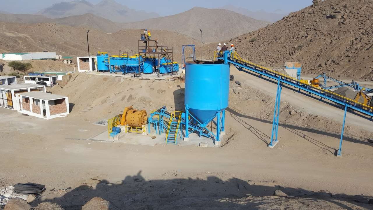
Regional setting, Ancash Department, Northern Peru.The Aguila Norte processing plant, approximately 292 km from Minas Yanayco by mostly asphalt roads.Project locations in Peru. Minas Yanayco is not shown on this map.
Technical disclosureScientific and technical information relating to Minas Yanayco has been reviewed and approved by Jeffrey Reeder, P.Geo., Chairman, CEO and Director of Peruvian Metals Corp., who is a Qualified Person as defined under National Instrument 43-101. The Company’s mineral properties are exploration and development stage projects. Historical results, underground samples, grab samples and mine dump samples may not be representative of mineralization across the property. The property is early stage and is not the subject of a mineral resource estimate. There is no assurance that further exploration will identify mineralization of economic significance. Readers should review the Company’s full technical disclosure and public filings on SEDAR+ for additional information. Information presented on this page is drawn from the Company’s public disclosure, which is available on SEDAR+.